klostertalsommer16_alexkaiser.at-2888

272 Routes and tours

Overlay

Hiking Tours in the Region

Discover Nature on a variety of Hiking Tours

Discover all walks in the region including description, map, elevation profile and gpx file.

Flower Hiking Trail | Faschina

Flower Hiking Trail | Faschina

Flower Hiking Trail | Faschina

Length1,2 km Elevation gain290 m LevelModerate Duration0:45 h

A special feature in the Biosphärenpark Grosses Walsertal is the extraordinary plant diversity on the "Hahnenkopf" in Faschina, which has developed due to the geological conditions in this area.

Stafelalp cable car middle station, Faschina

Stafelalp cable car mountain station, Faschina

Circular Hike Garmauscha - Kaiser | Dalaas

Circular Hike Garmauscha - Kaiser | Dalaas

Circular Hike Garmauscha - Kaiser | Dalaas

Length4,2 km Elevation gain168 m LevelEasy Duration1:30 h

Short circular trail in Dalaas, which is easy to walk even in rainy weather.

Parking place Kristbergsaal, Dalaas

Parking place Kristbergsaal, Dalaas

Faschina - Hochschere Fürkele - Buchboden | Faschina & Buchboden

Faschina - Hochschere Fürkele - Buchboden | Faschina & Buchboden

Faschina - Hochschere Fürkele - Buchboden | Faschina & Buchboden

Length15,8 km Elevation gain855 m LevelDifficult Duration6:30 h

The mountain tour over the Hochschere Fürkele and the Hochschere Weg is one of the most challenging mountain tours in the Großes Walsertal and offers fabulous views.

Parking lot Faschinapass, Fontanella-Faschina

Church, Sonntag-Buchboden

Hochgerach, 1.985 m | Thüringerberg

Hochgerach, 1.985 m | Thüringerberg

Hochgerach, 1.985 m | Thüringerberg

Length15,4 km Elevation gain1109 m LevelDifficult Duration6:15 h

The Hochgerach is the second highest mountain of the Walserkamm and a worthwhile peak.

Village center, Thüringerberg

Village center, Thüringerberg

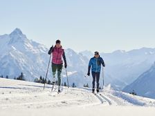
Cross-country ski trail "Olympia" | Bürserberg

Cross-country ski trail

Cross-country ski trail "Olympia" | Bürserberg

Length4,4 km Elevation gain36 m LevelEasy Duration1:00 h

Style: Classic / Skating on 80 % of the trail

Car park Tschengla, Bürserberg

Car park Tschengla, Bürserberg

closed

Außerbergweg | Bürs-Bürserberg

Außerbergweg | Bürs-Bürserberg

Außerbergweg | Bürs-Bürserberg

Length3,0 km Elevation gain267 m LevelEasy Duration1:00 h

Beautiful winter hike from Bürs to Bürserberg with great views of the alpine town of Bludenz.

Sports facility, Bürs

Village center, Bürserberg

Nenzinger Himmel above Amatschonjoch | Brand

Nenzinger Himmel above Amatschonjoch | Brand

Nenzinger Himmel above Amatschonjoch | Brand

Length22,4 km Elevation gain1332 m LevelDifficult Duration9:00 h

Magnificent panoramic views on the hike to the summer village of Nenzinger Himmel.

Dorfbahn mountain station, Brand

Nenzinger Himmel or Dorfbahn mountain station, Brand

Saladinaspitze, 2.238 m | Dalaas

Saladinaspitze, 2.238 m | Dalaas

Saladinaspitze, 2.238 m | Dalaas

Length7,2 km Elevation gain482 m LevelDifficult Duration4:00 h

Mountain tour with fabulous panoramic views of the Lechquellen mountains with Fensterlewand and Roter Wand, the Verwall and far into the Silvretta.

Bus stop Alpe Formarin, Dalaas

Bus stop Alpe Formarin, Dalaas

High altitude hiking trail | Brand

High altitude hiking trail | Brand

High altitude hiking trail | Brand

Length4,8 km Elevation gain199 m LevelModerate Duration2:00 h

On the high hiking trail, which runs above the village, you have a beautiful view of Brand.

Innertal, Brand

Innertal, Brand

Natursprünge-Weg | Brandnertal

Natursprünge-Weg | Brandnertal

Natursprünge-Weg | Brandnertal

Length4,7 km Elevation gain37 m LevelEasy Duration2:00 h

Learn about the nature of the Brandner Valley at eleven interactive stations along the Natursprünge-Weg! Fun and games for young and old are guaranteed along this trail in summer!

Panoramabahn mountain station or Dorfbahn mountain station, Brand.

Panoramabahn mountain station or Dorfbahn mountain station, Brand.

A short moment

We prepare the content…