Village circular route | Dalaas

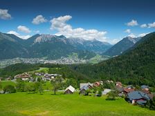
Village circular route | Dalaas
Length3,1 km Elevation gain72 m LevelEasy Duration1:15 h
Leisurely village trail through numerous parts of Dalaas.
272 Routes and tours
Overlay
Village circular route | Dalaas
Length3,1 km Elevation gain72 m LevelEasy Duration1:15 h
Leisurely village trail through numerous parts of Dalaas.

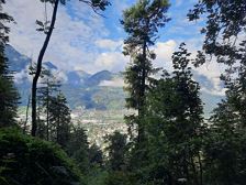
Montikel panoramic trail | Bludenz
Length4,6 km Elevation gain205 m LevelEasy Duration1:45 h
Very beautiful panoramic trail close to the city with many resting benches and beautiful viewpoints.
Water castle (on the right hand side of the valley station Muttersbergbahn), Bludenz
Leisure pool VAL BLU, Bludenz

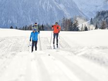
Cross-country ski trail "Innertal" | Brand
Length3,2 km Elevation gain48 m LevelModerate Duration1:00 h
Style: Classic
Palüdbahn valley station or village centre, Brand
Palüdbahn valley station or village centre, Brand
closed

Circular hiking trail Allmeinkreuz | Braz
Length5,2 km Elevation gain185 m LevelEasy Duration2:00 h
Beautiful circular hiking trail with magnificent views of the surrounding mountains, especially the striking Roggelskopf.

Circular trail "Biotop Schloss Rosenegg" | Bürs
Length2,6 km Elevation gain69 m LevelEasy Duration1:00 h
Easy circular hike to the biotope and the ruins of Rosenegg Castle in Bürs.

Length2,2 km Elevation gain85 m LevelEasy Duration0:45 h
Comfortable and easy winter circular hike on the Tschengla high plateau.

From Buchboden to Klesenza Alpe | Sonntag-Buchboden
Length17,5 km Elevation gain755 m LevelModerate Duration3:00 h
One of the most beautiful mountain bike tours in the Grosses Walsertal with a breathtaking mountain panorama.

Obere Furkla - Elser Fürkele - Muttersberg | Bludenz
Length12,9 km Elevation gain1282 m LevelModerate Duration6:15 h
Challenging hike with tremendous views down into the Walgau and Klostertal valley.

Toboggan run Sonntag-Stein | Sonntag
Length7,0 km Elevation gain279 m LevelModerate Duration1:30 h
Hike along the winter hiking trail up to the Unterpartnom Alpe before returning to the mountain station of the gondola lift on a toboggan.
Mountain station cable car Sonntag-Stein, Sonntag
Mountain station cable car Sonntag-Stein, Sonntag
closed

Bürserberg circular trail via Zugs parcel | Bürserberg
Length3,4 km Elevation gain98 m LevelEasy Duration1:15 h
This trail leads you from the center in Bürserberg via the Zugs parcel in a beautiful circular tour back to the starting point.
A short moment
We prepare the content…