klostertalsommer16_alexkaiser.at-2888

272 Routes and tours

Overlay

Hiking Tours in the Region

Discover Nature on a variety of Hiking Tours

Discover all walks in the region including description, map, elevation profile and gpx file.

Burtscha-Tour | Bürserberg

Burtscha-Tour | Bürserberg

Burtscha-Tour | Bürserberg

Length5,3 km Elevation gain443 m LevelEasy Duration1:45 h

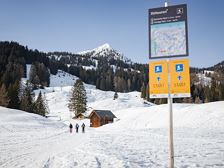
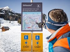
Short, signposted beginner's ski tour from the Tschengla up to the Burtschasattel.

Car park Tschengla, Bürserberg

Car park Tschengla, Bürserberg

Faregg-Tour | Bürserberg

Faregg-Tour | Bürserberg

Faregg-Tour | Bürserberg

Length5,7 km Elevation gain480 m LevelEasy Duration2:00 h

Signposted beginner ski tour via the Alte Statt trail up to the Burtschasattel.

Car park Tschengla, Bürserberg

Car park Tschengla, Bürserberg

Via Zimbajoch to the Lünersee | Brand

Via Zimbajoch to the Lünersee | Brand

Via Zimbajoch to the Lünersee | Brand

Length16,9 km Elevation gain1880 m LevelDifficult Duration9:00 h

Challenging mountain tour through the Sarotla valley and over the Zimbajoch to the Lünersee.

Village centre, Brand

Lünersee cable car valley station, Brand

Panorama Trail | Klösterle am Arlberg

Panorama Trail | Klösterle am Arlberg

Panorama Trail | Klösterle am Arlberg

Length5,8 km Elevation gain179 m LevelModerate Duration2:00 h

Enjoy great views along the panoramic circular trail from Klösterle to Danöfen and back.

Tourist office, Klösterle am Arlberg

Tourist office, Klösterle am Arlberg

Mottakopfweg | Bürserberg

Mottakopfweg | Bürserberg

Mottakopfweg | Bürserberg

Length4,4 km Elevation gain124 m LevelEasy Duration1:30 h

Pleasantly short hike to Mottakopf on the Tschengla high plateau.

Car park Tschengla, Bürserberg

Car park Tschengla, Bürserberg

Via ferrata Kellenegg | Brand

Via ferrata Kellenegg | Brand

Via ferrata Kellenegg | Brand

Length1,5 km Elevation gain184 m LevelModerate Duration1:15 h

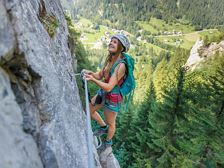
Very beautifully designed, short via ferrata in Brand with difficulty level C.

Village center, Brand

Village center, Brand

closed

Hike to water places | Sunday-Buchboden

Hike to water places | Sunday-Buchboden

Hike to water places | Sunday-Buchboden

Length7,7 km Elevation gain100 m LevelEasy Duration2:30 h

Beautiful hike to special water places in the biosphere park Grosses Walsertal: Natural monument Kessi-Gorge, iron spring Bad Rothenbrunnen, tuff spring and sulfur spring.

Church, Sonntag-Buchboden

Church, Sonntag-Buchboden

Glatthorn, 2.133 m | Fontanella-Faschina

Glatthorn, 2.133 m | Fontanella-Faschina

Glatthorn, 2.133 m | Fontanella-Faschina

Length5,9 km Elevation gain365 m LevelModerate Duration3:30 h

Summit tour on the Glatthorn above Faschina with fabulous views of the surrounding mountains.

Car park at the Faschinajoch, Fontanella-Faschina

Car park at the Faschinajoch, Fontanella-Faschina

A short moment

We prepare the content…