Culinary Pleasure Tour | Bürserberg

Culinary Pleasure Tour | Bürserberg
Length12,5 km Elevation gain629 m LevelModerate Duration4:45 h
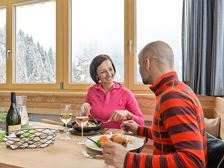
With this culinary offer, the name says it all: be active and enjoy sports at the same time.
272 Routes and tours
Overlay
Culinary Pleasure Tour | Bürserberg
Length12,5 km Elevation gain629 m LevelModerate Duration4:45 h
With this culinary offer, the name says it all: be active and enjoy sports at the same time.

Circular route to the acoustic resting place "Hellwald" | Bludenz
Length5,5 km Elevation gain314 m LevelEasy Duration2:15 h
Beautiful circular trail above Bludenz to the "Hellwald" acustic rest stop, which provides playful sound entertainment for young and old.

Burtschasattel circuit hike | Bürserberg
Length4,4 km Elevation gain254 m LevelModerate Duration1:45 h
Leisurely round tour from the Burtschasattel down towards Tschengla and back via the Burtscha Alpe.

Kulturweg "Historischer Dorfrundweg" | Nüziders
Length8,7 km Elevation gain512 m LevelEasy Duration3:30 h
Interessanter Kulturweg zu historischen Plätzen in der Sonnenberg Gemeinde Nüziders.

Kulinarische Genussrunde (Winterwanderung) | Großes Walsertal
Length11,8 km Elevation gain350 m LevelModerate Duration3:15 h
Bei diesem kulinarischen Angebot ist der Name Programm: Sportlich aktiv sein und gleichzeitig genießen. Unterwegs – egal, ob zu Fuß oder mit den Skiern – besuchen Sie drei Genuss-Stationen und werden von den Gastgebern mit regionalen Köstlichkeiten verwöhnt. Entlang des Weges genießen Sie die Natur und das herrliche Bergpanorama des Großen Walsertals.

Tschengla circular trail | Bürserberg
Length1,8 km Elevation gain59 m LevelEasy Duration0:45 h
Family-friendly hike on the sunny Tschengla high plateau.

Loischkopf circular trail | Bürserberg
Length6,1 km Elevation gain318 m LevelModerate Duration1:45 h
BANNED until 15 June 2024 due to the protection concept for capercaillie (the ban applies annually).
Easy circular trail around the 1,809 m high Loischkopf.

Length8,1 km Elevation gain496 m LevelModerate Duration3:30 h
Beautiful hike along the Schesatobel from the Einhornbahn II valley station up to the Frööd restaurant at the Burtschasattel.

Viewpoint circular hike | Bürserberg
Length11,4 km Elevation gain617 m LevelModerate Duration4:00 h
Panoramawanderung zu den Aussichtspunkten am Schesatobel und am Loischkopf.

Length8,3 km Elevation gain278 m LevelModerate Duration2:45 h
Leisurely hike with panoramic views at the "Niggenkopf" and "Palüd" viewpoints.
A short moment
We prepare the content…