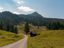
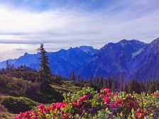
Muttjöchle, 2.074 m | Wald am ArlbergMuttjöchle, 2.074 m | Wald am Arlberg Length8,0 km Elevation gain1084 m LevelEasy Duration2:30 hBeautiful family hike past idyllic high moors and flowering mountain meadows up to the Muttjöchle. Sonnenkopf cable car mountain station, Wald am Arlberg Sonnenkopf cable car mountain station, Wald am Arlberg
Village circular path | Wald am ArlbergVillage circular path | Wald am Arlberg Length4,4 km Elevation gain104 m LevelEasy Duration1:25 hLeisurely village tour along the Alfenz river and through numerous districts of the vacation resort Wald am Arlberg in the Klostertal valley. Sonnenkopf cable car valley station, Wald am Arlberg Sonnenkopf cable car valley station, Wald am Arlberg
Schillerkopf, 2.006 m | BürserbergSchillerkopf, 2.006 m | Bürserberg Length8,5 km Elevation gain813 m LevelModerate Duration4:30 hA varied mountain hike across meadows, through woods and over rocky terrain up to the 2,006 m high Schillerkopf. Hiking parking lot Tschengla, Bürserberg Hiking parking lot Tschengla, Bürserberg
Circular hiking trail | BürserbergCircular hiking trail | Bürserberg Length8,1 km Elevation gain371 m LevelModerate Duration3:00 hA panoramic winter hiking tour from Bürserberg village centre to the Tschengla high plateau. Village center (church), Bürserberg Village center (church), Bürserberg
Alvierbachweg | BrandAlvierbachweg | Brand Length5,0 km Elevation gain89 m LevelEasy Duration1:30 hQuiet, partly shady walk along the Alvierbach stream in Brand. Village centre, Brand Village centre, Brand
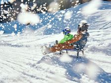
Toboggan run Löcher | BürserbergToboggan run Löcher | Bürserberg Length1,4 km Elevation gain- LevelModerate Duration0:20 hAn action-packed descent by toboggan awaits you at the Löcher toboggan run in Bürserberg! Einhornbahn I mountain station, Bürserberg Einhornbahn I valley station or village centre, Bürserbergclosed
To the Plansott Alpe | St. GeroldTo the Plansott Alpe | St. Gerold Length12,8 km Elevation gain663 m LevelModerate Duration2:15 hEasy MTB tour with great views of the Großes Walsertal. St. Gerold St. Gerold
Around the Zafernhorn | Fontanella-FaschinaAround the Zafernhorn | Fontanella-Faschina Length25,9 km Elevation gain1286 m LevelDifficult Duration4:00 hVery beautiful and challenging MTB tour with single trail passages around the Zafernhorn in Fontanella-Faschina. Faschinapass, Fontanella-Faschina Faschinapass, Fontanella-Faschina
To the Seewaldsee | FontanellaTo the Seewaldsee | Fontanella Length4,3 km Elevation gain112 m LevelEasy Duration1:00 hThe hike to the Seewaldsee is eventful from spring to autumn in any weather and offers a wonderful panoramic view over the Grosse Walsertal. Fontanella-Säge, Fontanella Seewaldsee, Fontanella
From the mountain station to the valley station Sonnenkopf | Wald am ArlbergFrom the mountain station to the valley station Sonnenkopf | Wald am Arlberg Length4,4 km Elevation gain- LevelEasy Duration2:00 hPretty walk for the family, from the mountain station to the valley station of the Sonnenkopf cable car. Sonnenkopf cable car mountain station, Wald am Arlberg Sonnenkopf cable car valley station, Wald am Arlberg