Winter hiking trail "Hintergant" | Dalaas
Distance6,6 km
Elevation gain198 m
Negative altitude198 m
LevelEasy
Duration2:00 h
Distance6,6 km
Elevation gain198 m
LevelEasy
Duration2:00 h
A short moment
Loading map...
Winter hiking trail "Hintergant" | Dalaas
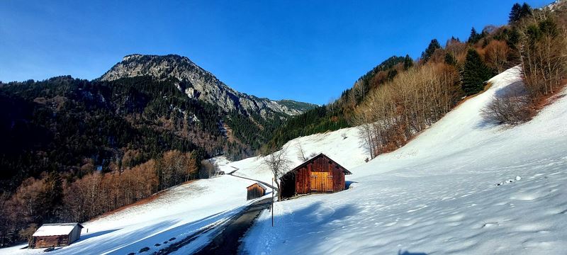
The start of this winter hike to the Dalaas district of Hintergant is at the Kristbergsaal in Dalaas. From here the trail leads over the bridge and then up Bahnhofsstraße to the parish church of St. Oswald. Past the church, stay on Bahnhofsstraße and branch off to the right in the direction of Dalaas railway station. At the station, cross the bridge and continue along the path towards Obermarias. After a short stretch, the path branches off to the left across a ravine and continues to Mason. In Mason, pass the chapel and continue towards the Hintergant parcel. The way back to Dalaas village centre is along the same path.
 Auf dem Weg Richtung Hintergant
 Geräumter Winterwanderweg Richtung Hintergant
 Maisäßhütten in Hintergant
 Blick von der gegenüberliegenden Seite auf Hintergant
Equipment
Sturdy shoes, warm clothing and walking sticks are recommended. Mobile phone in case of emergency.
Route description
Start: Kristbergsaal, Dalaas
End: Kristbergsaal, Dalaas
Centre of the village - Kristbergsaal - bridge - Bahnhofsstraße - Dalaas parish church - Dalaas railway station - over the railway bridge to Obermarias - then left on the hiking trail via Sand- and Hölltobel to Obermason - at the crossroads after Martinskapelle turn right over Gantegg to the Hintergant parcel - return the same wayProperties
- Scenic
- Out and back
- Way cleared
- Groomed snow
Emergency services
140 Alpine Emergencies throughout Austria
144 Alpine Emergencies Vorarlberg
112 Euro emergency call (works with any mobile phone/network)


