
Sunna-Weg: Stage 1 | Nüziders-Bludenz
Distance4,3 km
Elevation gain223 m
Negative altitude73 m
LevelEasy
Duration1:30 h
Distance4,3 km
Elevation gain223 m
LevelEasy
Duration1:30 h
A short moment
Loading map...
Sunna-Weg: Stage 1 | Nüziders-Bludenz
The "Sunna-Weg" gets its name from its location on the sunny side of the valley and its course through the Sonnenberg community of Nüziders. Nüziders was once the ancestral seat of the county of Sonnenberg. On this hiking trail close to the town, 25 panels provide information with cultural-historical focal points. They also cover scenic, natural history and geological topics. The focus is always on conveying stories about people and the landscape.
Stage 1
The first stage of the theme trail runs from the "Hängender Stein" in Nüziders to the "Daneu" bridge in Bludenz. The start and end points and all entry points have been chosen so that they can be easily reached by public transport. Along the way, numerous loungers and benches invite you to enjoy the view of the surrounding mountains. For a short break or refreshment, there are several places to stop along the way.
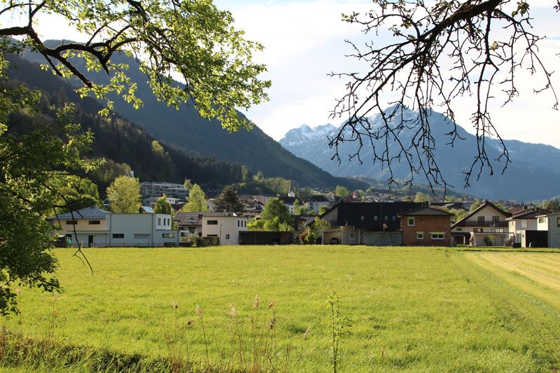 Blick vom Waldweg unterhalb des Hängenden Steins Richtung Nüziders
 Blick vom Wiesen-/Waldweg oberhalb des Gasthof Bad Sonnenberg zurück Richtung Hängender Stein
- Blick von der Ruine Sonnenberg hinunter auf das Ortszentrum von Nüziders
- Ruine Sonnenberg
- Einer der zahlreichen Aussichts- und Rastplätze entlang des Weges
- Letztes Wegstück der ersten Etappe Richtung Südtiroler Siedlung/Daneubrücke
- Wanderwegenetz Vorarlberg


Equipment
Ankle-high shoes with treaded soles, sun and rain protection, snack, filled water bottle and first aid kit. Mobile phone for emergencies.
Route description
Start: Parkingstation at the "Hängender Stein", Nüziders
End: "Daneu" bridge, Bludenz
Stage 1Start of the tour is at the parking lot of the "Hängender Stein" in Nüziders. From here along the Walgauweg in the direction of Nüziders. After about 15-20 minutes you will reach the first houses of the Nüziders community. The path leads here for a short distance through the village. At the Bad Sonnenberg inn, the path branches off along a meadow and forest path in the direction of the Sonnenberg ruins (access to the meadow and forest path: above the parking lot, a narrow footpath branches off to the right). Alternatively, this section can also be done through the village of Nüziders and along the Schloßweg. At the end of the Schloßweg, directly at the Sonnenberg ruins, both trail variants meet again in the "Kälberbünt" district. From here, the path leads uphill for a while along the forest road. At the next fork with signposts, follow the trail in the direction of Kreuzboden, Hinteroferst and Nüziders. From here continue on forest roads and forest paths. On this section of the trail, there are always short breaks at rest areas with loungers - the vantage point "Grafen Känzele" is particularly beautiful. The Grafen Känzele is not directly on the path, but the short detour is definitely worth it - there is also the information board No. 5 and a sensational view awaits you. The trail continues along the forest path, past the Maria Brünnele and on towards Bludenz. The last part of the first stage leads you out of the forest over a meadow to the South Tyrolean settlement and further to the Daneu bridge.
Route
Hängender Stein, Nüziders - Walgauweg - Gasthof Bad Sonnenberg - meadow/forest path - Sonnenberg ruins - Schloßweg - Kälberbünt - Kreuzboden - Oberdaneu - Daneubrücke, Bludenz
Possible access and descent
- at Gasthof Bad Sonnenberg in the direction of the municipal office Nüziders
- at the Schloßweg direction Gemeindeamt Nüziders
- at Kreuzboden in the direction of Nüziders town center
Properties
- Multi-stage route
- Scenic
- Refreshment stops available
- Cultural/historical interest
Emergency services
140 Alpine Emergencies throughout Austria
144 Alpine Emergencies Vorarlberg
112 Euro emergency call (works with any mobile phone/network)