Schesaplana via Mannheimer Hütte (2 days) | Brand
Distance24,9 km
Elevation gain2060 m
Negative altitude2053 m
LevelDifficult
Duration9:30 h
Distance24,9 km
Elevation gain2060 m
LevelDifficult
Duration9:30 h
A short moment
Loading map...
Schesaplana via Mannheimer Hütte (2 days) | Brand
A narrow mountain path leads you from the Innertal car park past the Palüdbach stream and the Glingabrunnen fountain, a series of springs with underground inflow from the Brandner Glacier, towards the Mannheimer Hut. The hiking trail runs through the Zalimtal valley, past the Obere Brüggele Alpe via serpentines to the Oberzalim Hut. Via the Leiberweg, a climb partly blasted into the rock, you reach the Mannheimer Hut. An overnight stay at the Mannheimer Hut is recommended. The next day, the route takes you over the Brandner Glacier (tracked, marked and generally easy to walk on) to the highest peak in the Rätikon, the Schesaplana. The descent is via the hiking trail to the Totalphütte and on a well-trodden trail (be careful in spring - snowfields!) on to the Lünersee and via the Bösen Tritt to the Schattenlaganthütte. Walk back to Brand to the Innertal car park. From the Lünersee cable car mountain station, the tour can also be shortened with the Lünersee cable car and the bus line 580.
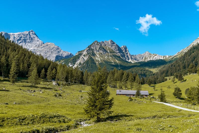
 Durch das Zalimtal geht es bergwärts Richtung Oberzalimhütte.
 Kurze Pause auf der Oberzalimhütte auf 1.889 m.
 Blick zurück hinunter ins Zalimtal.
 Der Leibersteig - Trittsicherheit und Schwindelfreiheit ist hier Voraussetzung.
 Die letzten Meter bis zum Tagesziel.
 Atemberaubender Sonnenuntergang mit Blick auf die Schesaplana.
 Die Mannheimer Hütte auf 2.679 m - hochalpiner Stützpunkt im Rätikon.
 Tagerwachen im Rätikon.
 Über den Brandner Gletscher hinauf zur Schesaplana.
 Unterhalb der Schesaplana an der schweiz-österreichischen Grenze.
 Am Gipfel der Schesaplana angekommen.
 Atemberaubender Blick vom Gipfel Richtung Lünersee.
 Abstieg über die Totalphütte zum Lünersee.
 Zurück am Lünersee.
 Wanderwegenetz Vorarlberg
Equipment
Sturdy shoes, warm clothing, rain and sun protection, snack and filled water bottle as well as hiking poles are recommended. Additional equipment for an overnight stay in a refuge. Mobile phone in case of emergency.
Route description
Start: Parking place Innertal, Brand
End: Parking place Innertal, Brand
Day 1: Innertal car park - Palüdbach/Glingabrunnen - Zalimtal - Oberzalim Hut - Leibersteig - Mannheimer Hut = approx. 5 hDay 2: Mannheimer Hut - Brandner Glacier - Schesaplana - Totalphütte - Lünersee cable car mountain station - Böser Tritt - Lünersee cable car valley station - possibly continue to Innertal car park or alternatively bus line 580 = approx. 4 1/2 h
Properties
- Scenic
- Insider tip
- Summit route
- Round trip
- Refreshment stops available
- Cableway ascent/descent
- Exposed sections
- Secured passages
- Ridge
Emergency services
140 Alpine Emergencies throughout Austria
144 Alpine Emergencies Vorarlberg
112 Euro emergency call (works with any mobile phone/network)


