
Klostertal Bike Trail | Klostertal
Distance47,4 km
Elevation gain515 m
Negative altitude515 m
LevelEasy
Duration3:45 h
Distance47,4 km
Elevation gain515 m
LevelEasy
Duration3:45 h
A short moment
Loading map...
Klostertal Bike Trail | Klostertal
From Bludenz, the route first goes along the Ill River to Brunnenfeld. From the traffic junction at the Bludenz-Montafon freeway exit, the Klostertal cycle path leads into the valley on the shady side along the Alfenz river. You pass Stallehr and ride along the valley floor past Außer- and Innerbraz. At Dalaas, the valley becomes so narrow that the bike path briefly leads onto the village street, which is little frequented thanks to the Arlberg expressway. At the end of the village, the route continues on a gravel road along the Alfenz, past Außerwald, the valley station of the Sonnenkopfbahn and Innerwald to Klösterle am Arlberg. Return via the same route.
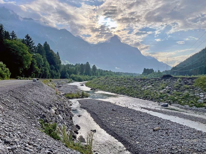 Der Klostertal Radweg führt immer entlang der Alfenz hinein ins Klostertal
 Klostertal Radweg entlang der Alfenz
- Beschilderung entlang des Klostertal Radweges
- Grillstelle und Rastplatz entlang des Klostertal Radweges
- Mountainbike-Regeln


Equipment
Mountain bike, helmet, rain or sun protection, small snacks and enough water to drink. Mobile phone in case of emergency.
Route description
Start: Bludenz
End: Klösterle am Arlberg
Bludenz - cycle path along the Ill - Brunnenfeld - Bludenz-Montafon traffic junction - turn off onto Klostertal cycle path - Stallehr - Außerbraz - Innerbraz - Dalaas - Dorfstraße - gravel road at the end of the village - Wald am Arlberg - Sonnenkopf cable car valley station in Wald am Arlberg - Klösterle am Arlberg - returnProperties
- Out and back
- Refreshment stops available
- Family-friendly
Emergency services
140 Alpine Emergencies throughout Austria
144 Alpine Emergencies Vorarlberg
112 Euro emergency call (works with any mobile phone/network)