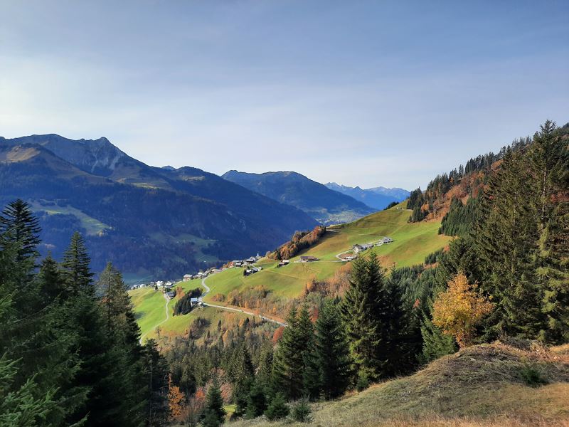
Blasenka, 2.004 m & Hochlicht, 2.109 m | Fontanella
Distance13,2 km
Elevation gain1045 m
Negative altitude1045 m
LevelModerate
Duration6:00 h
Distance13,2 km
Elevation gain1045 m
LevelModerate
Duration6:00 h
A short moment
Loading map...
Blasenka, 2.004 m & Hochlicht, 2.109 m | Fontanella
The hike starts at the car park at the "Säge" in Fontanella. From here a very short stretch along the road in the direction of Seewaldsee before the hike branches off to the left. A rather steep path leads up through the forest in the direction of Brüche. Here you come out above the tree line and the small plateau with the Zafernmaisäß opens up. A little below the upper Maisäß huts, the path branches off in the direction of the Bärenalpe. Past the Bärenalpe for the hiking trail over two smaller ravines (short rope safety) always slightly ascending. Then the trail leads through a rather steep grassy slope up to a small Joch. At the Joch, the trail branches off to the right in the direction of Hochlicht and Blasenka. At both summits you can enjoy a fabulous panoramic view. The first part of the way back to the Bärenalpe is on the same path. At the Bärenalpe the path branches off to the left. Through the forest it goes over a quite steep path along the Seewaldtobel down towards the Seewaldsee. At the Seewaldsee you can stop for a break and walk around this little natural jewel before returning the last few meters along the road to the starting point.
 Blick zurück Richtung Fontanella
 Zafernmaisäß
 Bärenalpe
 Kurze seilversicherte Stelle nach der Bärenalpe
 Blick talauswärts während des Aufstiegs
 Hochlicht, 2.109m
 Blick Richtung Zitterklapfen
 Blasenka, 2.004m
 Ausblick vom Gipfel der Blasenka
 Ausblick während des Abstiegs Richtung Seewaldsee
 Seewaldsee
 Schöne Stimmung beim herbstlichen Seewaldsee
 Zurück zum Ausgangspunkt mit Blick Richtung Fontanella
 Wanderwegenetz Vorarlberg
Equipment
Ankle-high mountain boots with tread sole, sun and rain protection, snack, filled water bottle and first aid kit. Hiking poles are recommended. Cell phone for emergencies.
Route description
Start: Car park at the "Säge", Fontanella
End: Car park at the "Säge", Fontanella
Parking at the "Säge" in Fontanella - tootpath - Brüche- Zafernmaisäß - Bärenalpe - Hochlicht - Blasenka - Bärenalpe - Seewaldtobel - Seewaldsee - road until the parking at the "Säge" FontanellaProperties
- Scenic
- Summit route
- Round trip
- Refreshment stops available
- Secured passages
Emergency services
140 Alpine Emergencies throughout Austria
144 Alpine Emergencies Vorarlberg
112 Euro emergency call (works with any mobile phone/network)


